One of the projects we have been engaged in recently is an analysis of the archaeological landscape of the August 1922 Battle for Cork, the largest engagement of the revolutionary decade in the county. Despite its scale and importance (the engagement led to the fall of Cork City), no detailed efforts to identify and map this archaeological landscape or interpret the physical battlefield have previously been attempted. In 2020 the Landscapes of Revolution Project teamed up with Professor Joanna Brück of UCD School of Archaeology, Dr John Borgonovo of UCC School of History (and author of The Battle for Cork: July-August 1922) and Niall Murray of UCC School of History to explore this landscape and to identify and assess any surviving elements. Valuable input and advice was also received from Joe Healy and Robert Allison of the Passage West Maritime Museum.
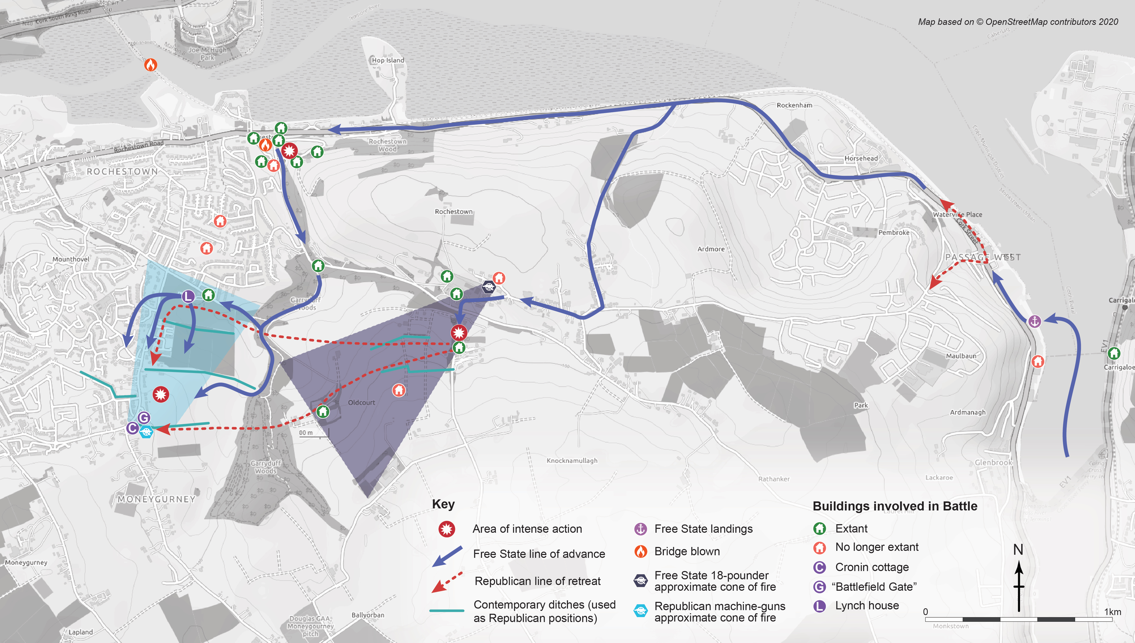
The initial phase of the project has concentrated on the first two days fighting (8-9 August), which centred on Passage West and Rochestown (it is hoped analysis of the landscape around Douglas Village pertaining to the third day will follow). It quickly became apparent that a highly significant and largely unprotected conflict landscape survives associated with the 1922 fighting. Among the many identified elements are features such as incoming and outgoing bullet impact scars, surviving structures utilised for everything from strongpoints to field hospitals, damage associated with efforts to block access routes, and extant field boundaries which played crucial roles for both sides in attack and defence. The survival and archaeological potential of this Irish Civil War battlefield is extremely high, and it offers significant opportunity for on-site interpretation.
Some of our initial analysis will be the subject of a forthcoming brief publication (of which more in a future post), and we hope to be able to develop and expand on our initial work. But for now we wanted to make available our initial map of this rich archaeological landscape, covering the Passage West and Rochestown elements of the fighting. You can explore it in detail below by clicking on the image. There will undoubtedly be much more to add into the future, but this currently represents the most detailed landscape map of features associated with one of Ireland’s most significant Civil War clashes.