In late 2021, Tipperary Studies received a unique early 20th-century map on-loan from a local family. This family carefully looked after the map known to them as the “Old IRA Map” for decades and graciously permitted its digitisation to ensure its detail is preserved for future generations.
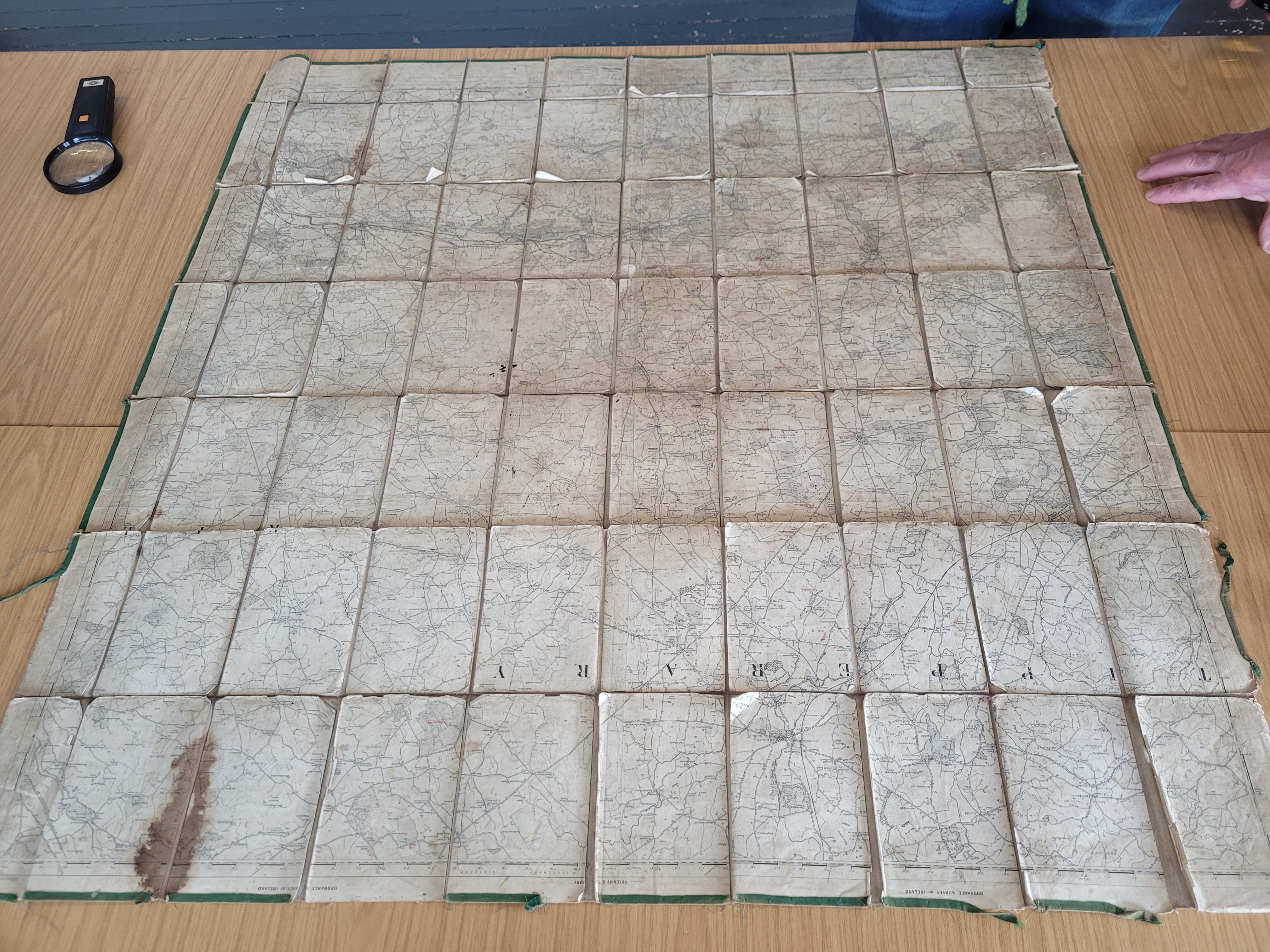
What makes this particular map so special is that there are a number of annotations and markings in the area where the 3rd Tipperary Brigade IRA operated. These marks may indicate the location of possible IRA routes through the countryside, roadblocks, rendezvous points, and possibly the scenes of actual or intended ambushes.
Though the identity of the individual who created the map and its precise date of origin is yet to be established, we hope that with the assistance of the local community, this project may shed some light on the topic.
Abarta Heritage, through the Landscapes of Revolution Project, has been appointed by Tipperary Heritage Office to undertake a public-facing project on the map as part of its Decade of Centenaries Programme. Over the coming months, we will host talks and workshops about how the public can interact with the revolutionary landscape around them and how they can explore the potential meanings behind some of the annotations and markings on the map.
We will also hold object-recording days, where we encourage local people who may have objects from the War of Independence or the Civil War to bring them in for recording. To keep everyone updated on the progress of this exciting project, we will issue a number of blogs and social media posts through our Landscapes of Revolution accounts.
The first event of the ‘Tipperary IRA Map Project’ was the virtual Inception Talk which was held on Tuesday the 8th of March at 7 pm.
If you would like to see the fantastic digitised version of the map, click here.
As the project has progressed, we have conducted a series of local events, as well as undertaking investigations into the map itself. You can catch-up with the blog posts we have produced as part of the project via the links below.
Blog Posts
Tipperary IRA Map Inception Talk, 8th of March 2022
A Closer Look at the Tipperary IRA Map
Tipperary Old IRA Map Upcoming Object Recording & Memory Sharing Evening
Cashel Object Recording & Memory Sharing Evening
A Closer look at the markings on the ‘Tipperary Old IRA Map’
Revolutionary Research Evening in Cahir
Revolutionary Research Evening Presentation
Looking North and to our Next Event
Revolutionary Show & Tell Event