A Project Exploring Ireland's Conflict Archaeology, 1913-1923
Cloyne RIC Barracks Attack, 1920
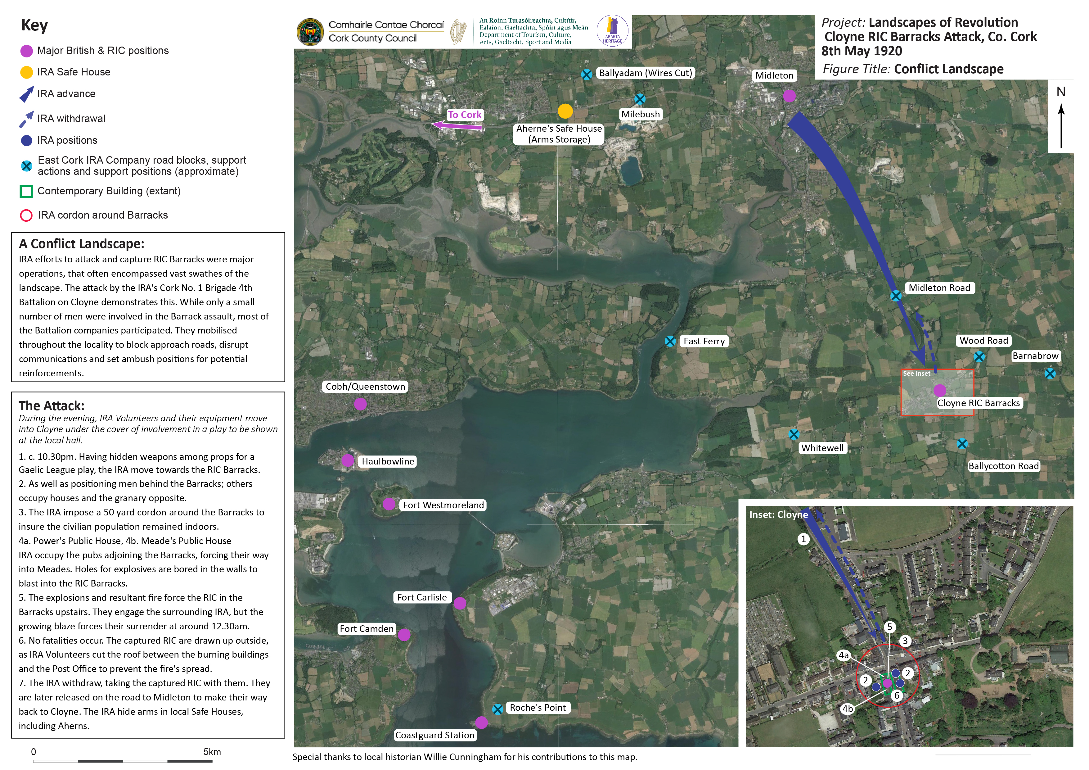
The Landscapes of Revolution Project are currently working with Cork County Council on a project to map the archaeological landscape of the 8 May 1920 Cloyne RIC Barracks Attack in East Cork. The operation saw Volunteer companies combine to undertake different tasks as they sought to successfully capture the RIC station in the centre of the town. The map that was produced for this project is available below (click on images to enlarge).
The Conflict Landscape of the Cloyne RIC Barracks Attack- Click on image to enlarge (Landscapes of Revolution/Abarta Heritage)
This building housed the RIC barracks in Cloyne in 1920. The IRA attacked it from both the front and sides during their attack (Landscapes of Revolution)
The Cloyne RIC Barracks Attack Mapping Project is funded as part of Cork County Council’s Decade of Centenaries Programme financed by the Department of Tourism, Culture, Arts, Gaeltacht, Sport and Media. It is being delivered by Abarta Heritage as part of the Landscapes of Revolution Project.