A Project Exploring Ireland's Conflict Archaeology, 1913-1923
Crossbarry Ambush, 1921
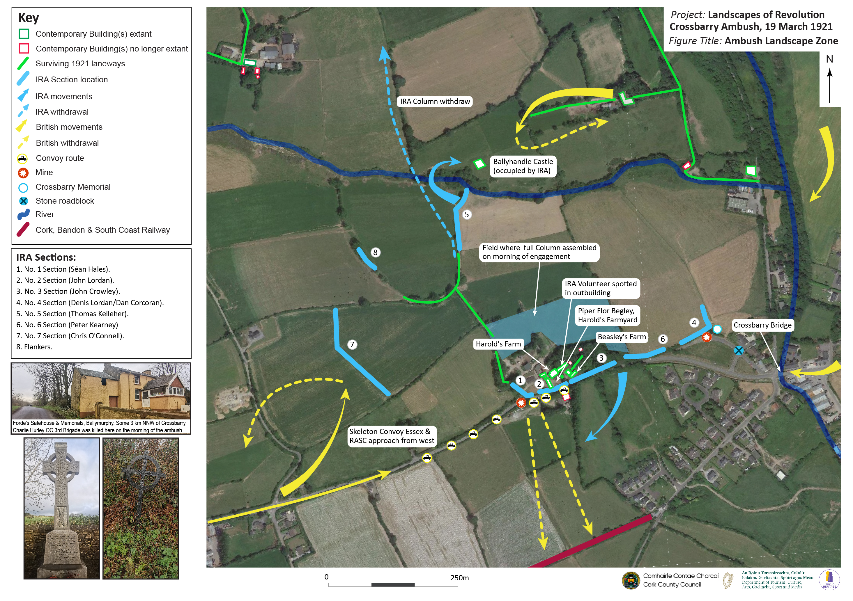
The Landscapes of Revolution Project are currently working with Cork County Council on a project to map the archaeological landscape of the 19 March 1921 Crossbarry Ambush in Co. Cork. The ambush was the largest in this history of the War of Independence, with other 100 IRA volunteers under Tom Barry engaging British forces. Work on the project is ongoing and the map which will result from the work will become available on the site at a later date.
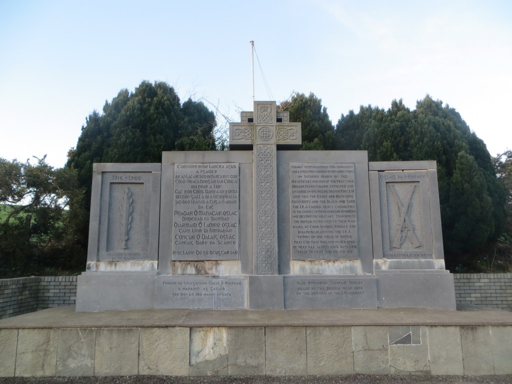
The Crossbarry Ambush memorial, unveiled in 1966. This prominent and important feature of the conflict landscape is what dominates visitor perceptions of the site today, but it is located on land that was perisperhal to the ambush itself. Many archaeological elements of the 1921 landscape survive, offering insight into the fighting of 19 March (Landscapes of Revolution).
Crossbarry Mapping
The Conflict Landscape of the Crossbarry Ambush- Click on image to enlarge (Landscapes of Revolution/Abarta Heritage)
The Crossbarry Ambush Mapping Project is funded as part of Cork County Council’s Decade of Centenaries Programme financed by the Department of Tourism, Culture, Arts, Gaeltacht, Sport and Media. It is being delivered by Abarta Heritage as part of the Landscapes of Revolution Project.