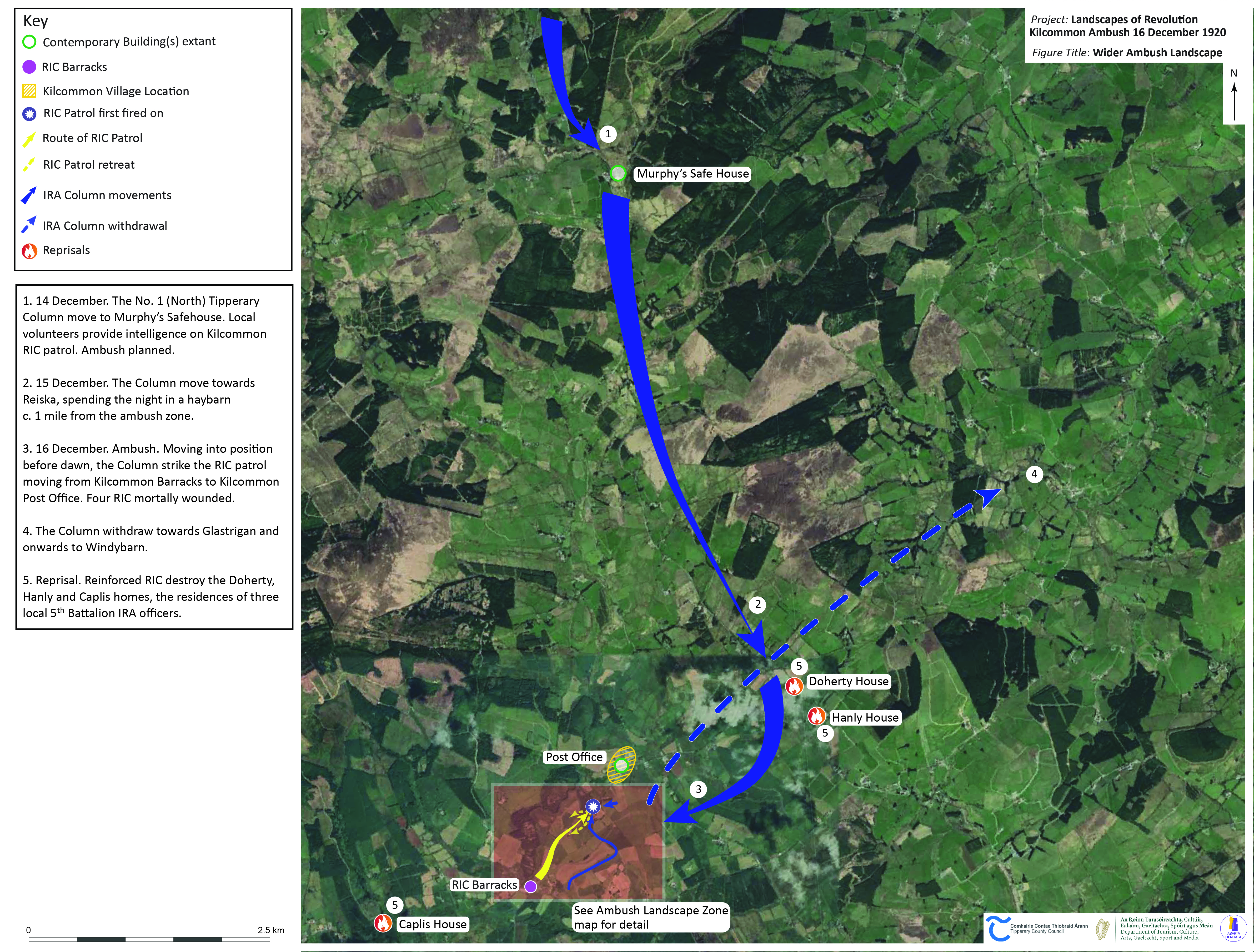
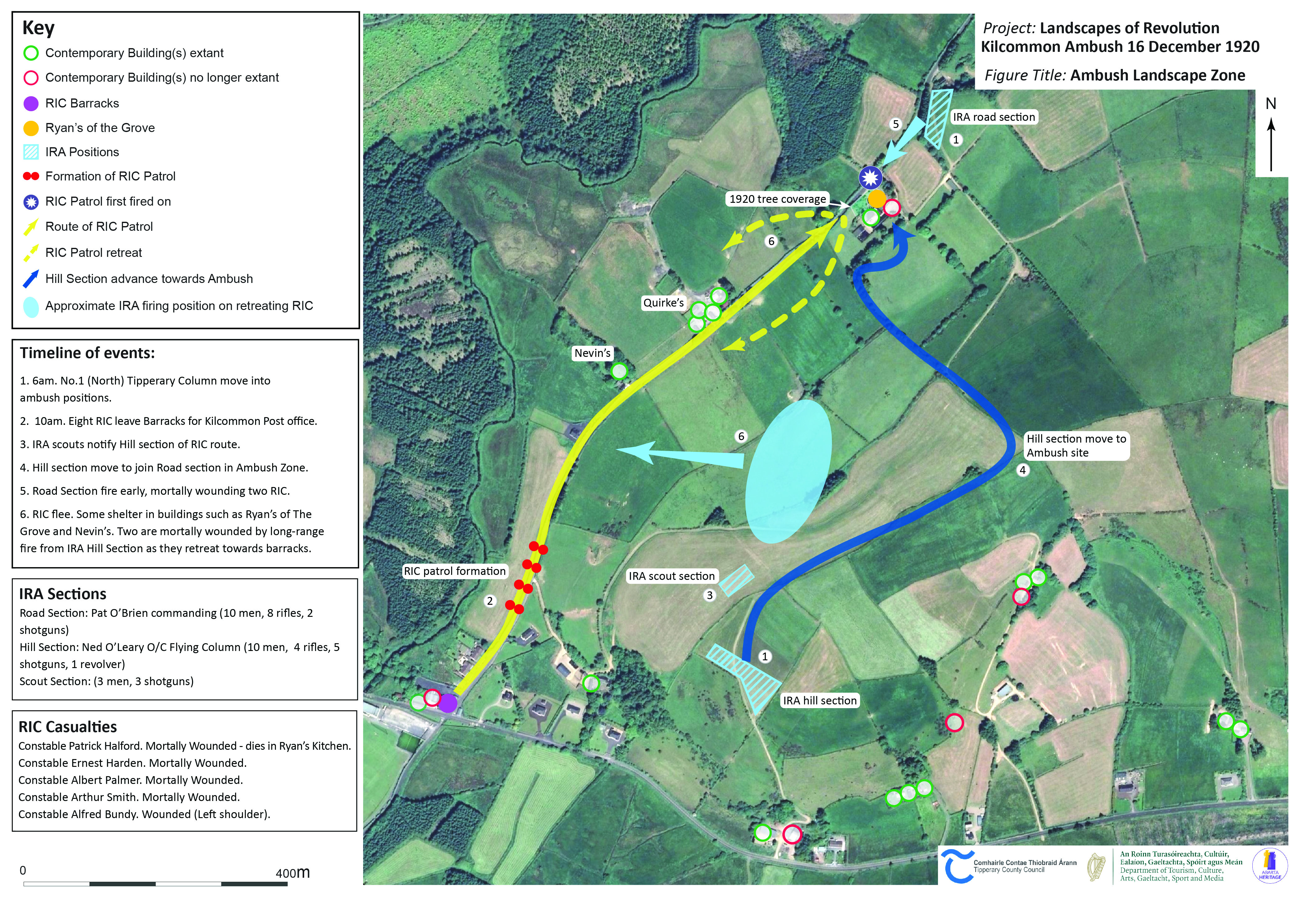
The Landscapes of Revolution Project is delighted to have teamed up with Tipperary County Council to map the archaeological landscape of the Kilcommon Ambush in partnership with the local community. The attack occurred on 16 December 1920, when the IRA Active Service Unit of the No. 1 (North) Tipperary Brigade launched an attack on an RIC patrol that had just left their barracks at Kilcommon Cross. Although the ambush was initiated prematurely, the firefight that followed resulted in the deaths of four members of the RIC. In the aftermath, the homes of a number of local IRA volunteers were targeted for reprisal.
Tipperary County Council have commissioned the Landscapes of Revolution Project to examine and map the archaeological landscape of the Kilcommon Ambush as part of their Decade of Centenaries Programme. A key component of the work will be to involve the local community in the process, through a series of events including a project inception talk, a research workshop, and a concluding talk on the results. Across the summer of 2021 a series of updates will also be provided here on the Landscapes of Revolution website. You can check back on this page to keep track of those updates and the results, all of which will be made freely accessible online.
Kilcommon Blog Posts
New Release: Archaeological Maps of the 1920 Kilcommon Ambush
Kilcommon: Research Workshop & Memory Sharing Event
Press Release: Landscapes of Revolution Project Workshop & Memory Gathering Event
The Kilcommon Ambush: In Search of Safehouses & Reprisals
The Kilcommon Ambush Inception Talk, 21 July 2021
Kilcommon Ambush: An Interview with Tipp FM
Kilcommon Mapping
Kilcommon Ambush Online Talks