A Project Exploring Ireland's Conflict Archaeology, 1913-1923
Mallow Barracks Raid, 1920
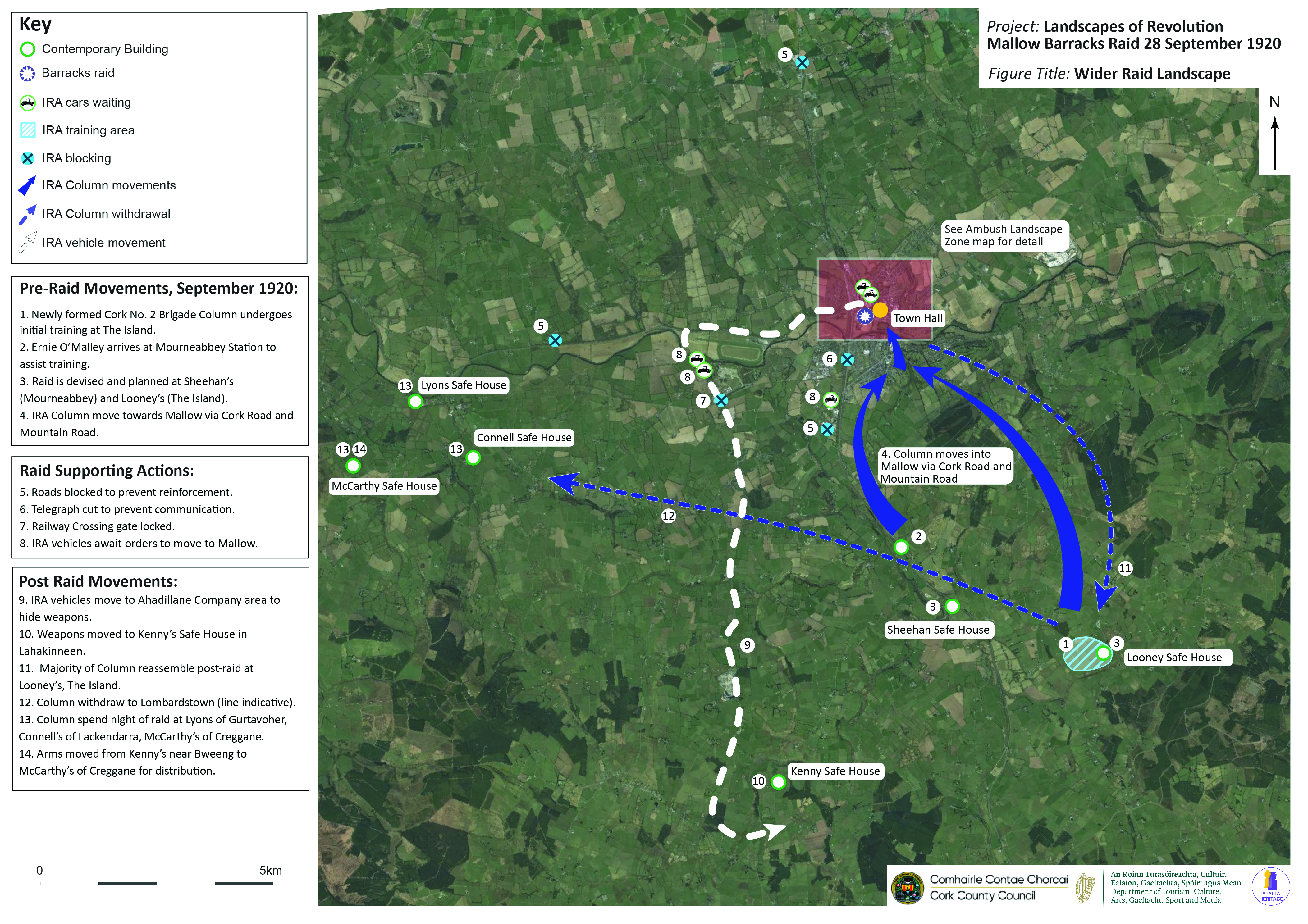
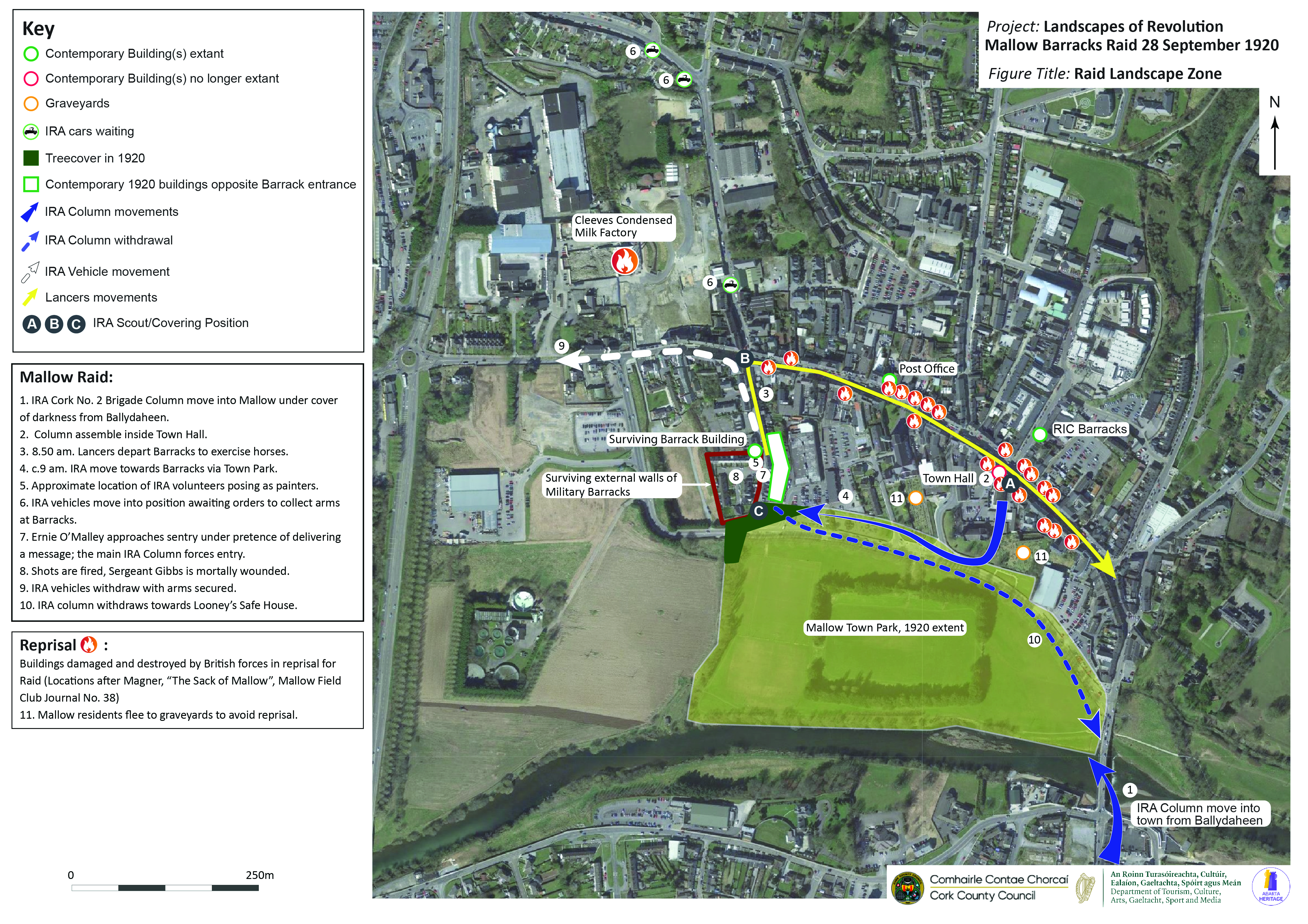
The Landscapes of Revolution Project are currently working with Cork County Council on a project to map the archaeological landscape of the 28 September 1920 Mallow Barracks Raid in Co. Cork, where Ernie O’Malley and Liam Lynch oversaw a successful operation to seize arms from the town’s military barracks. The maps that were produced for this project is available below (click on images to enlarge).
The Wider Conflict Landscape of the Mallow Raid- Click on image to enlarge (Landscapes of Revolution/Abarta Heritage)
The Mallow Raid Landscape Zone- Click on image to enlarge (Landscapes of Revolution/Abarta Heritage)
The conflict archaeology of absence. These buildings on Mallow’s Main Street record their construction date of 1924 on the cast iron drainpipe. They replaced premises that were destroyed during the reprisals that followed the 1920 Mallow Barracks Raid (Abarta Heritage/Landscapes of Revolution)
The Mallow Raid Mapping Project is funded as part of Cork County Council’s Decade of Centenaries Programme financed by the Department of Tourism, Culture, Arts, Gaeltacht, Sport and Media. It is being delivered by Abarta Heritage as part of the Landscapes of Revolution Project.