
Today we are focusing our attention on the northern section of the ‘3rd Brigade Map’. This area which covers towns and villages such as Holycross, The Commons and Thurles, was actually part of Tipperary’s 2nd Brigade zone.
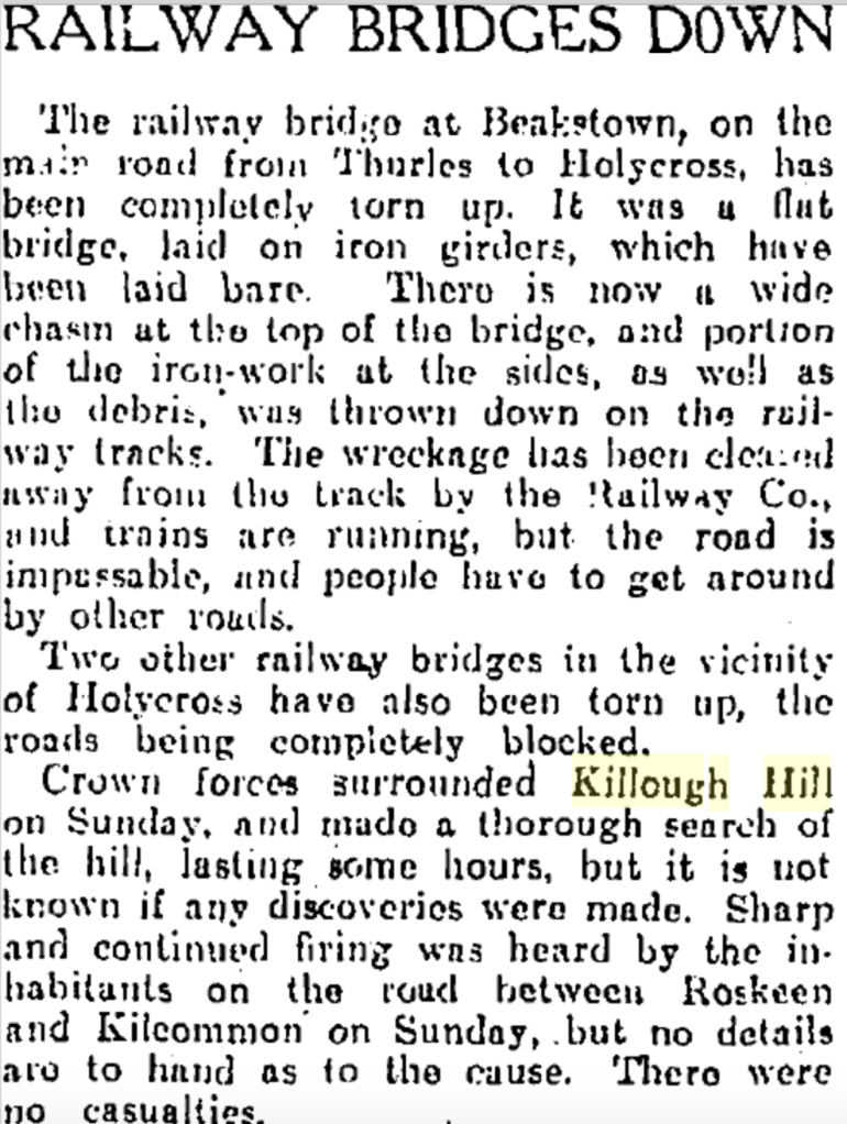
The markings on this part of the map are more sparse, but you can find some red underlines at Baltarsna, Ballinunty, Kilcooley Abbey and Killough Hill. The latter was the site of an intensive search by crown forces in 1921 after the IRA disrupted railway lines in the area.
Black markings can also be found on the northern part of the map. For example, the constabulary barracks in The Commons is underlined in black ink and ‘T’s’ have been written over Littleton, Tullaronan and Gortnahoo. These mimic the printed ‘T’s’ at Windgap and Clogheen and, according to the map’s legend, indicate the presence of telegraph offices.
It would appear that further telegraphs were installed after the map was printed, and the person making the markings wished to note their presence. This is interesting as the IRA were known for cutting communication during attacks and would often dismantle telegraph poles and cut wires, as was noted in the attack on Littleton’s RIC barrack, which you can read about here.
The upper part of the map also boasts blue track marks near Gortfree, black ink track marks near Ballinunty crossed by a pencil track mark which you can see on the image below.

These track marks pass through land connected to Ballinunty House, Waterloo Lodge, Lickfinn House and Ballyphilip House. If anyone has any information about these markings we would love to hear them. You can email us at Landscapes@abartaheritage.ie or tell us in person at our next event; a ‘Revolutionary Show & Tell‘ evening in The Source, Thurles (Eircode: E41 A4E8).
This free event will take place on Tuesday, the 19th of July, from 18:00-19:30. All are welcome to attend and share their stories or objects connected to the War of Independence and the Civil War. We are interested in all sectors of society; whether your family were in the RIC, IRA or just an innocent bystander, all of their experiences make up this dynamic time in Irish history. If you don’t have a story or an object come along anyway and hear whats others have to say.
As The Source is the current home of the Tipperary 3rd Brigade Map, the original will be on display for attendees to see. For more information and to book a place, click here.
The ‘Revolutionary Show & Tell’ event is part of the Tipperary Old IRA Map Project, funded by Tipperary County Council’s Decade of Centenaries Programme with support from the Department of Tourism, Culture, Arts, Gaeltacht, Sport and Media.
This event is being delivered by Abarta Heritage as part of the Landscapes of Revolution Project.
