
Our latest map is the third in the series commissioned by Cork County Council, and examines the archaeological landscape of the May 1920 attack on Cloyne RIC Barracks in East Cork. It follows previous maps we have undertaken for this project that explore the 1920 Mallow Military Barracks Raid and the 1921 attack on Rosscarbery RIC Barracks. The work was undertaken by Abarta Heritage Ltd as part of Cork County Council’s Decade of Centenaries Programme supported by the Department of Tourism, Culture, Arts, Gaeltacht, Sport and Media. As with our previous maps, it is intended to serve as a starting point for those interested in the exploration, examination and future management of the archaeological remnants of these important sites.
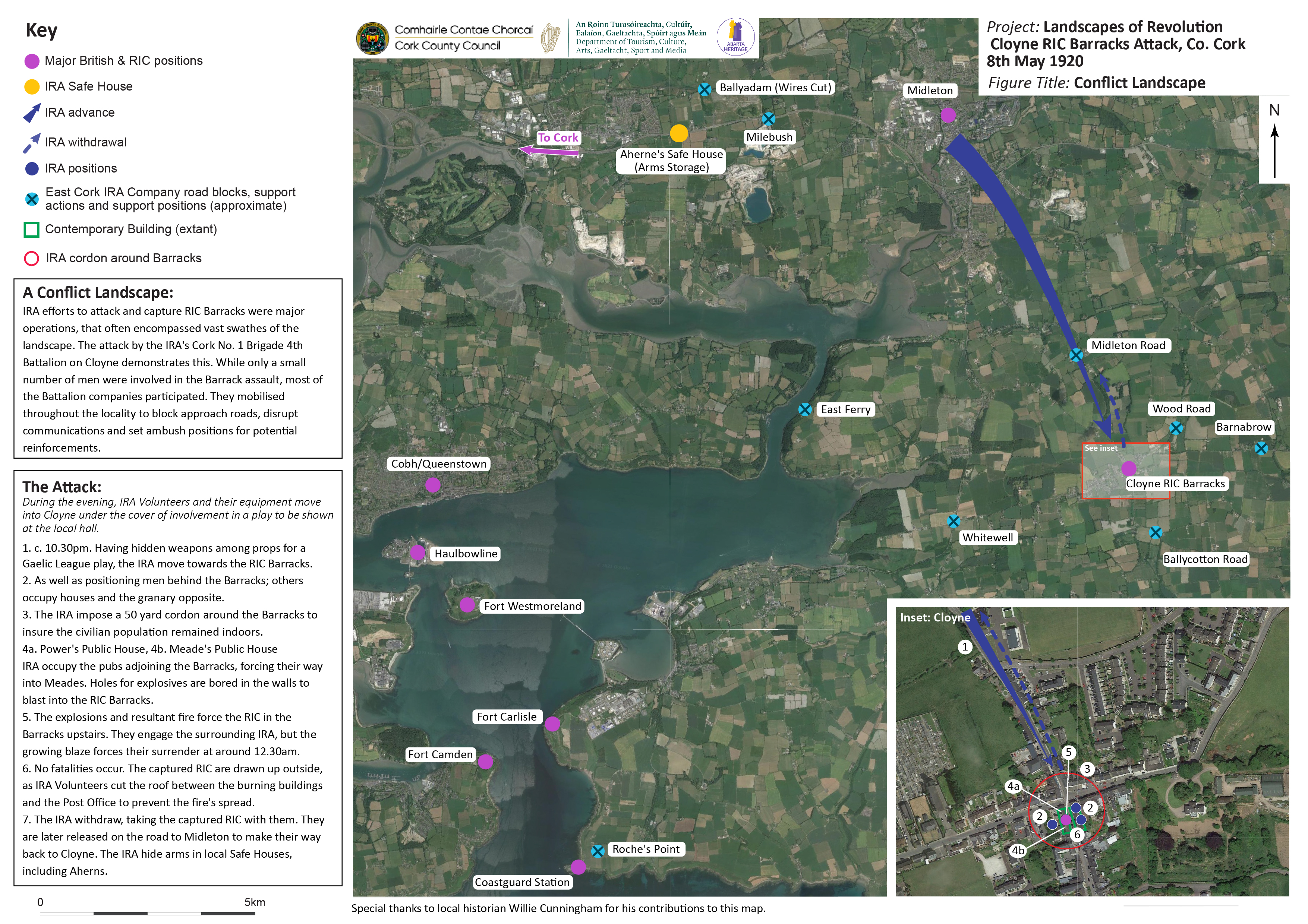
The locationary indicators left behind by the participants in the attack by the IRA’s 4th Battalion of the Cork No.1 Brigade serve to visually demonstrate just how large revolutionary conflict landscapes can be. Although at first glance the story of the 8th May Cloyne attack is one of a relatively straight-forward assault on a building, in fact it was an operation that extended across miles of countryside, involving IRA companies from throughout the 4th Battalion area, each performing a specific task. In common with many of the operations conducted by the IRA at this time, specific Volunteer companies tended to be assigned different roles depending on both their geographic location and available expertise. In East Cork, and particularly prior to the formation of the Flying Column later in 1920, it was the Cobh and Midleton companies that tended to be assigned the principal “strike” roles during operations. The other Volunteer companies were usually tasked with a series of a supporting functions, which although they rarely required direct engagement with the enemy were nonetheless vital for operational success.
When it came to the decision to strike Cloyne RIC Barracks, the biggest consideration was trying to prevent-or at least slow- military/RIC reinforcements. The East Cork IRA operated in a landscape where they were particularly vulnerable to rapid enemy response, given the scale of military and RIC personnel scattered around positions like the Cork Harbour Forts, Cork City, and major towns like Cobh (Queenstown) and Midleton. As a result, for the Cloyne operation various 4th Battalion companies were tasked with blocking roads, cutting communications and establishing secondary ambush positions at specified locations throughout the East Cork countryside to cut off Cloyne and hamper any relief efforts once the attack commenced. The approximate locations of some of these positions are marked on our map.
The map inset focuses on the Barracks attack itself. The IRA strike force moved into Cloyne under cover of a play that was to be performed in a local hall the next day. Hiding their weapons among the props, they successfully concealed their concentration from the RIC and avoided raising suspicion. Where difficulties did arise was when the Volunteers moved to the attack. The selected men sought to take up position around the Barracks in preparation for the assault. While access to Power’s Public House to the north of the Barrack building was secured relatively easily, they were initially denied entry into Meade’s Public House, to the south. As a result, they had to force their way into the pub through the front door. The IRA now had possession of the buildings on either side of the Barracks, and also occupied positions behind and opposite their target to keep the RIC pinned down. With everything set, the Volunteers began to bore holes through the walls of the pubs towards the Barracks, with the aim of planting explosives. Once it became apparent what was occurring, the trapped RIC began firing signal flares into the night sky, hoping to call support from the surrounding locality. It never materialised, but in the event that it had, the significant planning and precaution taken in preparing road blocks and other impediments would have proved its worth.
Back inside Meade’s pub, the IRA placed their gelignite into the wall and detonated it. But the breach it created on the ground floor of the Barracks was too small for them to enter, and the RIC were able to fire back through it, into the pub. The Volunteers responded by flipping their remaining gelignite through the breach, scattering the defenders. They followed this up with copious quantities of petrol and a lit cloth, and soon both the Barracks and Meade’s pub were ablaze. The conflagration forced the RIC upstairs, but also caused the IRA to leave their own position in the ground floor of Meade’s. Meanwhile, the Volunteers in Power’s planted their explosives and succeeded in blowing a hole into the ground floor of the Barracks from the opposite side. However, the rising flames they were met with from inside the building prevented entry. Given their dire situation, it wasn’t long before the RIC signalled their surrender. With the Barracks taken, attention turned to gathering up the prisoners and preventing the spread of the blaze to surrounding homes. Once all was in hand, a search of the Barracks revealed a small amount of arms and ammunition, that were spirited away to locations such as Aherne’s Safe House. With the battle over, the victorious IRA broke into a rendition of ‘The Soldiers Song’ and began to make their way out of Cloyne, together with their prisoners, whom they later released unharmed on the road to Midleton.
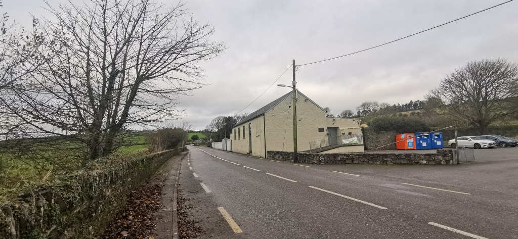
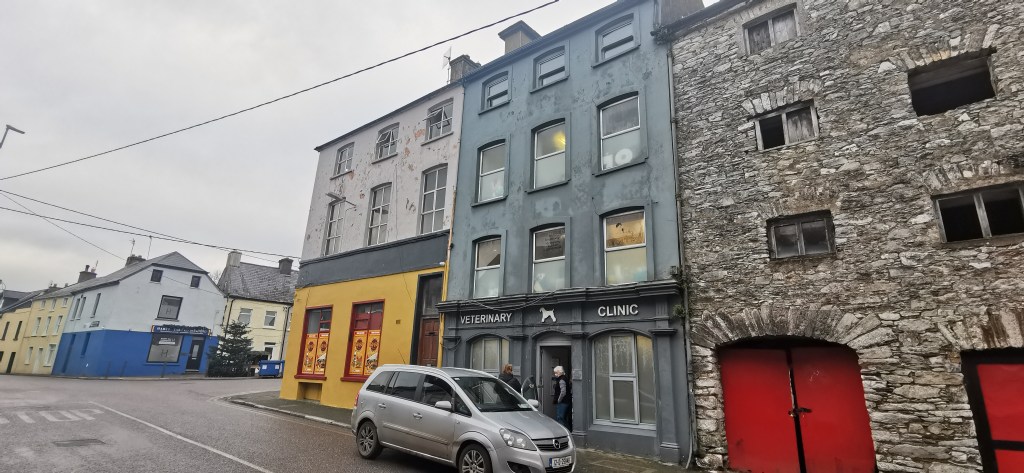
The IRA attack on Cloyne RIC Barracks was an extremely well-prepared and well-planned operation, and it met with considerable success. A key part of that success was the precautions taken through the region to prevent reinforcement and insure the isolation of the building’s occupants. Viewed from an archaeological perspective, Cloyne is fortunate in that all the buildings which played an immediate role in the fight for the Barracks survive much as they did in 1920, while many of the surrounding roads that were occupied and blocked follow the same or similar alignments to their historic predecessors.

As noted above, this map should be regarded as first steps towards the identification of archaeological elements of the Cloyne landscape, resources which can be built on into the future and serve as a tool for management and interpretation. We welcome any feedback or information with respect to site locations, additions or corrections to the mapping- and are particularly keen to hear from locals with knowledge of the hall where the IRA stored their arms prior to the attack- and of any historic photos of this or other key buildings involved in the attack. if you would like to contribute please contact us by emailing info@abartaheritage.ie. Once all four sites being featured in this Cork County Council funded project have been mapped and published online, Landscapes of Revolution will be organising an online talk to discuss the project and its results, so stay tuned for more details!
*Special thanks to local historian Willie Cunningham for his valuable assistance and input into the creation of this map.

Very interesting. Thanks Damian
LikeLike