
Our latest set of archaeological maps, examining the landscape of the important 1920 Mallow Barracks Raid, are the first in a series of four commissioned by Cork County Council. The work was undertaken by Abarta Heritage Ltd as part of Cork County Council’s Decade of Centenaries Programme supported by the Department of Tourism, Culture, Arts, Gaeltacht, Sport and Media. In addition to our work on Mallow we are in the midst of examining Cloyne (1920), Crossbarry (1921) and Rosscarbery (1921). These maps are intended to serve as a starting point for those interested in the exploration, examination and future management of the archaeological remnants of these important sites.
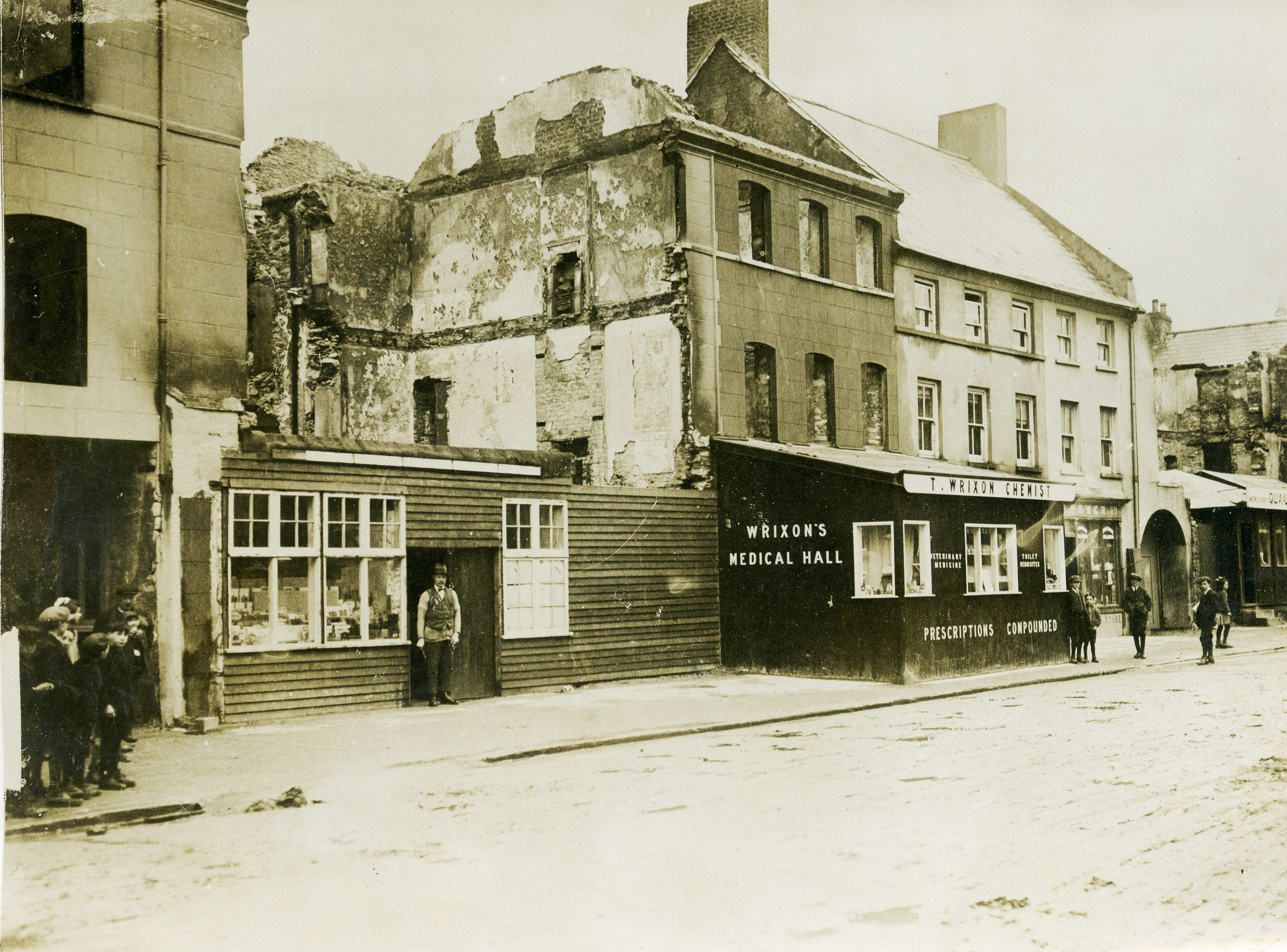
The Mallow Barracks Raid was conducted on 28 September 1920 by members of the newly formed Cork No. 2 Brigade IRA Flying Column. Waiting until the majority of the Lancers stationed in the Barracks were absent, the Column used subterfuge to force their way into the Barracks and quickly take control of it. The well-planned and coordinated strike allowed them to remove captured arms to waiting nearby vehicles before making good their escape. The raid represented the only occasion where a military barracks was taken by the IRA during the War of Independence. During the action, as the IRA had forced their way through the Barracks gate, shots were fired that struck and mortally wounded Sergeant William George Gibbs of the 17th Lancers. In reprisal for this killing, and the embarrassment of having lost the Barracks, retribution was taken on Mallow town. A large number of properties in and around the town centre were fired by British troops, causing substantial damage and destruction.
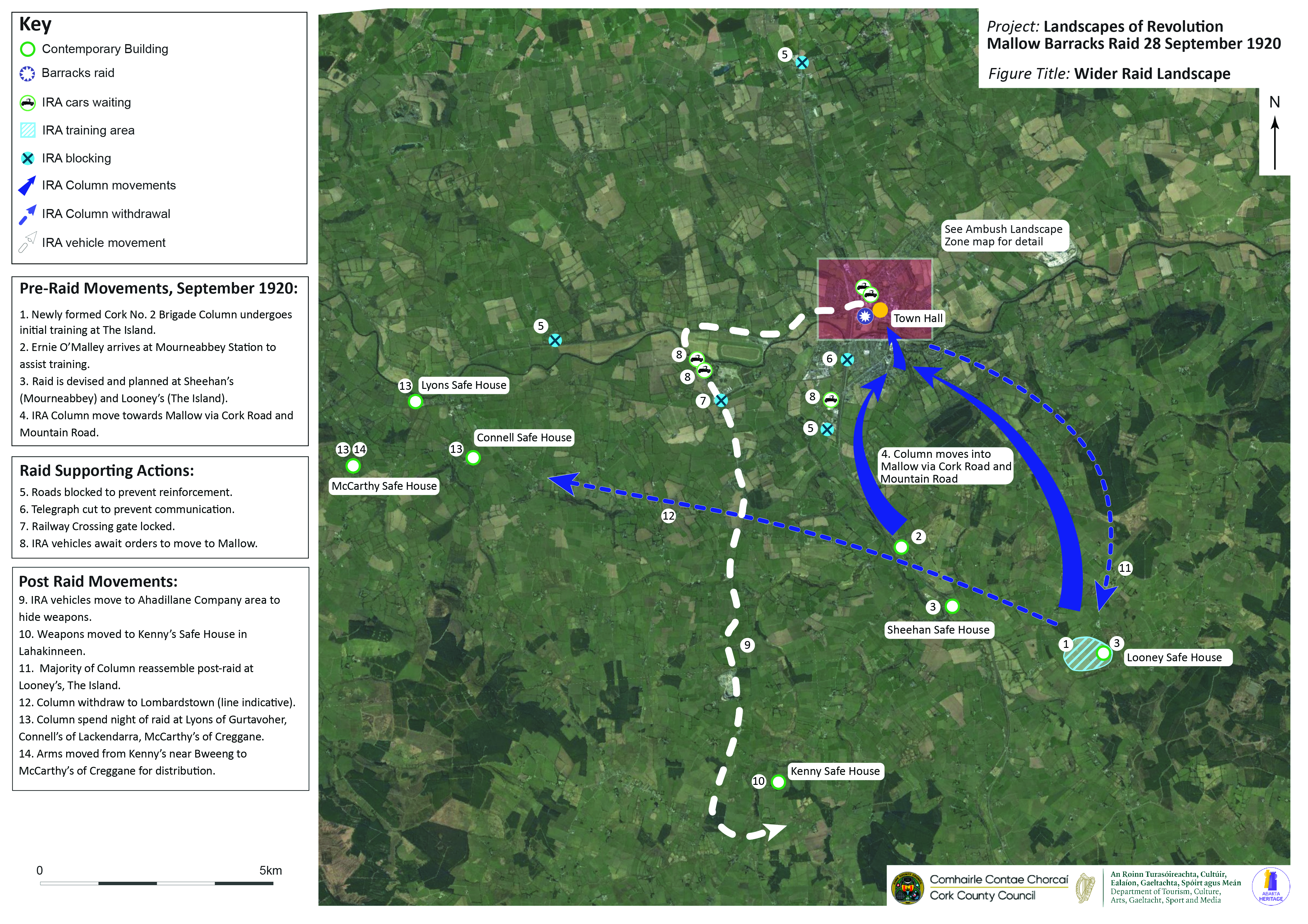
It quickly became apparent during the course of the project that while the Mallow Raid was an urban action, its archaeological imprint extends far beyond the town, incorporating organisation, planning, storage and assembly points that cover large swathes of the surrounding countryside. While not all of these could be mapped, a number of the key sites have been presented on a wider landscape map (see below). This locates features such as key safe-houses to townland level, and demonstrates some of the routes and movements of the IRA in the period leading up to and following the raid.
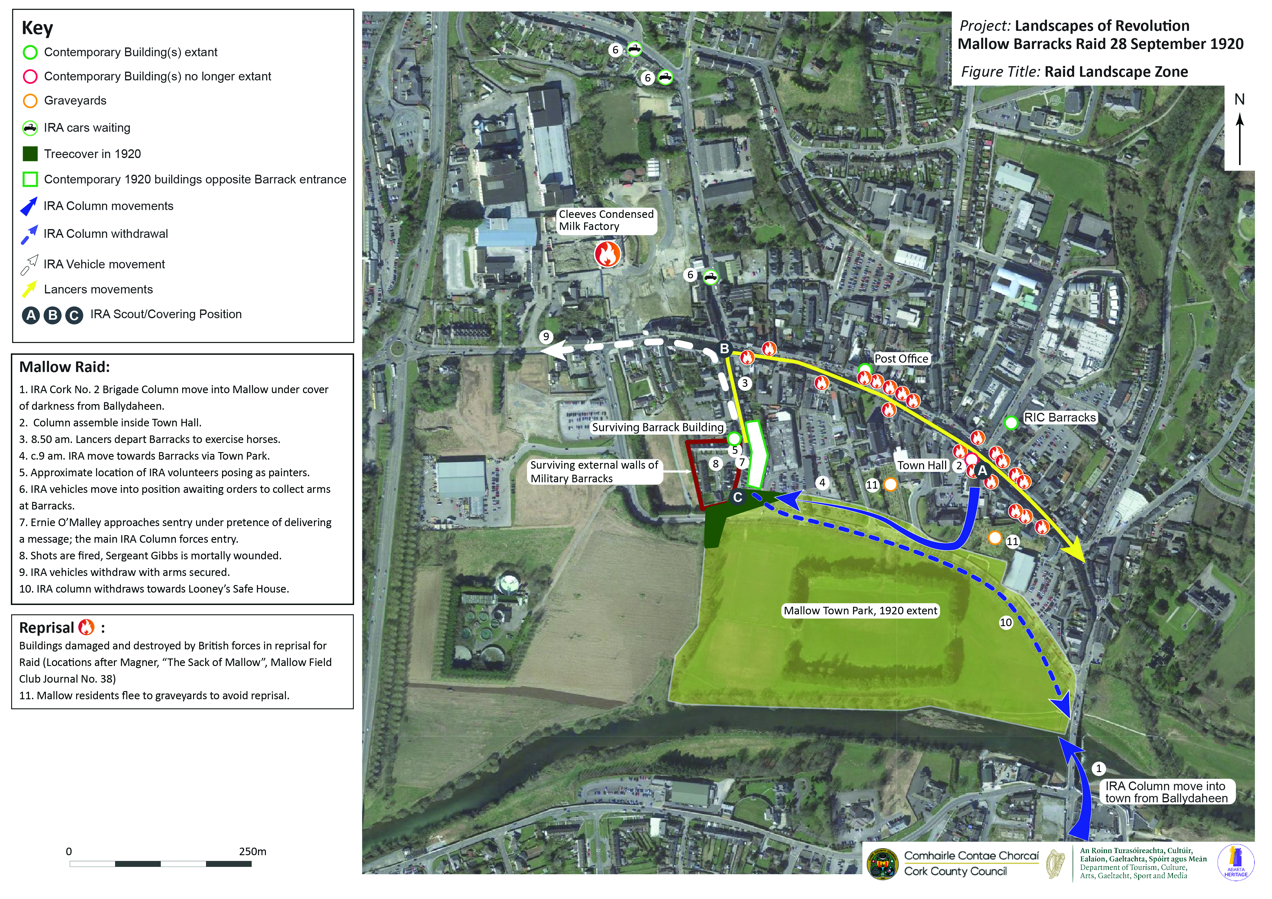
The second map takes a more detailed look at the town landscape, marking out the original extent of features such as the town park, and some of the surviving elements of structures like the military barracks. It places some of the key IRA positions and movements in the landscape, and seeks to incorporate some of the important local work that has been conducted on aspects such as the reprisal, notably the identification by Mehaul Magner of buildings damaged and destroyed as published in the Mallow Field Club Journal No.38.
As noted above, these maps should be regarded as first steps towards the identification of archaeological elements of the Mallow Raid landscape, resources which can be built on into the future and serve as a tool for management and interpretation. We welcome any feedback or information with respect to site locations, additions or corrections to the mapping- if you would like to contribute please contact us by emailing info@abartaheritage.ie. Once all four sites have been mapped and published online, the Landscapes of Revolution Project will be organising an online talk to discuss the project and its results, so stay tuned for more details!


1 comment for “New Release: Archaeological Maps of the 1920 Mallow Barracks Raid”