
As is evident in all the projects undertaken as part of Landscapes of Revolution, one of our main aims is to highlight the significant archaeological traces that the War of Independence and Civil War have left behind. Ireland has traditionally viewed the majority of its early 20th century conflict landscapes almost entirely through the prism of memory, a theme that has continued through the Decade of Centenaries. This manifests itself most visibly in the post-conflict memorials constructed at many key sites, a practice that is continuing to this day. While such memorials are often an integral and important part of the story of the revolutionary-era’s legacy, it is notable how frequently they overwhelm our perceptions of these conflict landscapes. Indeed, they are often so dominant that the contemporary 1919-23 conflict landscape in which they sit remains all but invisible to visitors. Perhaps the most obvious example of this is at Béal na Bláth, where the engagement of those who travel to the 1922 ambush site tends to be limited to interacting with the 1924 memorial. The majority depart with little knowledge of what in the landscape that surrounds them were there in 1922, or how that landscape influenced the engagement.
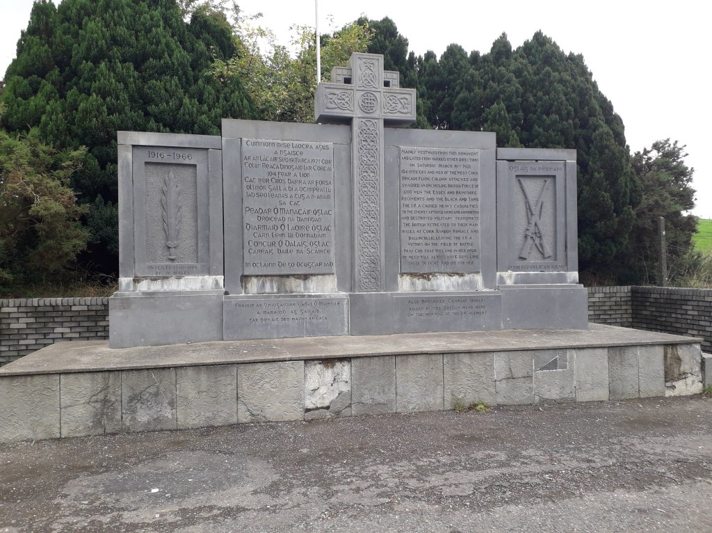
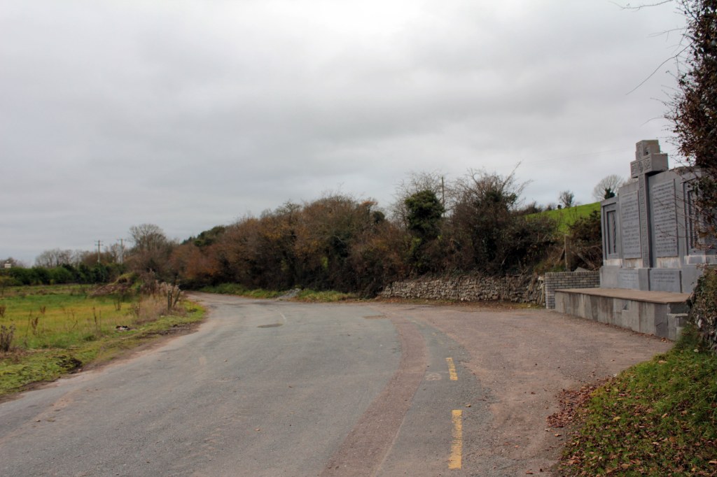
Another site where the memorial dominates perceptions of place is at Crossbarry, scene of the ambush of 19 March 1921. An extremely important monument in its own right, this 1960s memorial has understandably also become the place where people engage with Crossbarry as a site. Yet in terms of the actual 1921 fighting, the spot on which it is located represents only the eastern edge of the conflict landscape- indeed the core area of the action is to be found someway off to the west. As a result, few people have an opportunity to explore the remarkable survivals that mark out this important battlefield landscape, surely one of the best preserved 1921 conflict landscapes around. That is what makes the opportunity afforded to Landscapes of Revolution by Cork County Council to map some of the archaeological features of the Crossbarry Ambush landscape so exciting (for more on the Crossbarry project, see here). We have now begun detailed work on the project, compiling location indicators from contemporary sources and analysing historic maps.
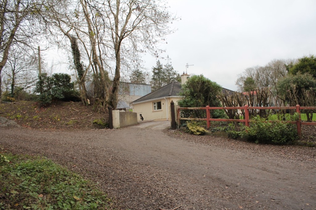
In the coming weeks will have more on our mapping work for Crossbarry (and the three other sites we are looking at for Cork County Council- Mallow, Cloyne and Rosscarbery). But for now we wanted to share a couple of images that demonstrate some of the immediately apparent key survivals within the landscape. The first is the small lane (pictured below) which marked the western-edge of the IRA position along the main road. On the day of the fighting this was sealed off with a stone roadblock in the immediate vicinity of where this photograph was taken. The bungalow present at the site did not exist in 1921, but was a field. Its boundary was lined with volunteers Seán Hales’ section, who were tasked with covering this laneway and preventing the main strike sections from being easily flanked.
One of the most striking aspects of the Crossbarry landscape is the survival of contemporary farm buildings associated with the Beasley and Harrold farms to the immediate east of this lane. They fronted the road at the very heart of the ambush site. It was in and around these farms that IRA volunteers under the likes of John Lordan and Mick Crowley engaged the British lorries that had been moving from west to east along the road. It was also in this area that one of the most famous acts of the War of Independence in Cork played out, when IRA volunteer Flor Begley, positioned in the Harrold farmyard, began to play stirring tunes on his pipes as the engagement commenced.
This core ambush zone is just one of a number of highly evocative contemporary survivals in the ambush area, there are others associated with the activities of IRA sections positioned further on the flanks and rear of the Column, and with the movements and operations of the British forces. Each of them helps us to explore the actions of Crossbarry in a different way, facilitating an engagement with the landscape that goes beyond its role as a landscape of memory, revealing it to also be a landscape of dramatic historical events.
Stay tuned to the website as we continue with our Cork County Council mapping projects and we share more on what emerges both at Crossbarry and elsewhere, culminating with the release of the maps themselves in the not too distant future!


